JOHN AND THE BIG GUY AT BIG SUR
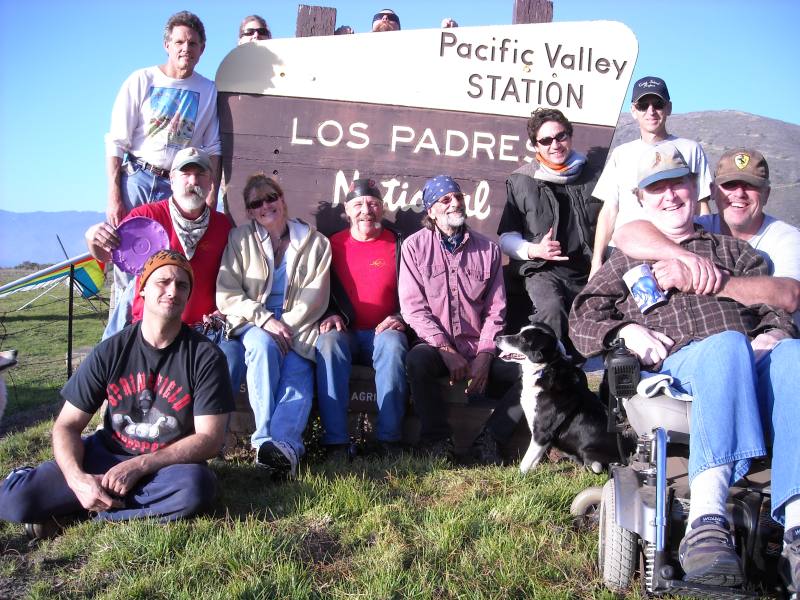
Last year’s Big Sur New Year’s celebration was fun with a good group of people, so I decided to spend the 2009 / 2010 transition at Pacific Valley with the Motherload Sky Riders. I arrived at Plaskett Creek campground an hour and a half before 2010. The Big Guy in the Sky had been on the mountain trying to catch launchable conditions. He carried his set-up glider from the west-side launch to the backside, but the switchy wind was messing with him.
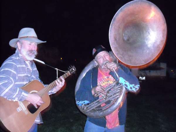 |
Shanon and Keith at the 08/09 celebration. People were walking in from all over the campground to see who was playing Auld Lang Syne on the Sousaphone. |
In the morning we drove up to the “House” launch where the Big Guy had left his glider set up over night. It was blowing in (over the back) so I set up Chris’ second 158 for a test flight. I had just done an IRAN(inspect/repair as necessary) on it, and I wanted to loop it before giving it back. Before we got off, the wind turned around west. We folded and drove to the launch south of the Knob where others were preparing to launch west. We began to set up. I delayed long enough to video the launches, so by the time Chris and I were ready, It had turned over the back again. We thought “No problem”. Last year we found that we can fly off the back and still make it out to the Ranger Station LZ.
One year ago today, bold pilot Scot Huber made the first-ever flight off the back-side of Knob Jr. on his ATOS and made it to the Ranger Station LZ with plenty of altitude to spare. The next day Shannon Rabe launched just north of Scot’s launch position on his Talon-2 and made it out no problem. Within an hour, the Big Guy, Ken Muscio and I had found (and named) the "House" launch, set up and launched into light backside wind. We arrived at the ranger station with enough altitude to do a couple loops.
Before this flight, I had not understood how the ridge curves towards the ocean. Once we made the flight, it seemed quite a reasonable thing to do. We were pleased with ourselves that we had discovered we can fly off the backside. Our mistake was to assume we can do it any time the wind is over the back. The Big Guy and I were about to find out that overall wind direction is important. South is good. North is bad.
GoPro camera on his keel looking forward, so he elected to follow me out. The last thing I said to Chris before launch was “The only thing that concerns me is; if it’s turbulent, I’m on the wrong glider”. Normally I would not fly a 158 Predator in the mountains. It is much too big for my 165 pound hook-in weight to control effectively. I was expecting a smooth sled run. I was about to be disappointed.
 |
The view down our backside launch run |
I launched into light wind straight up the slope. The air was smooth enough at first, but right away I felt I was not clearing the tall pines by much. Once we were headed west on the south side of the ridge the air turned turbulent. We were both sinking too fast, but I was having great trouble keeping the glider pointed west. With all my extra maneuvering, I was losing altitude faster than Chris.
We would conclude later that the wind this day was generally northwest to north; essentially splitting the ridge, sometimes coming up the west side and other times up the back, but always northerly. Where we were now is a bad place to be in a north. All of the friendly grassy alternate LZs we had seen on our flights out last year were well above us now. We were deep in Willow Creek Canyon and looking for a place to land.
As I looked around, there were no normal LZs. It was going to be a bush landing. There was a plateau just below my position, and everything from that point to the ocean was steep canyon walls. As I looked to the other side of the canyon, I was looking into the sun which was a couple hours from the horizon. I could not see anything in that direction. Not that there were no places to land. I just could not see them. My eyesight is not what it used to be. As your rods and cones deteriorate with age, you lose the ability to see in shadowed areas.
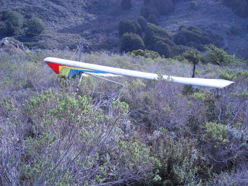
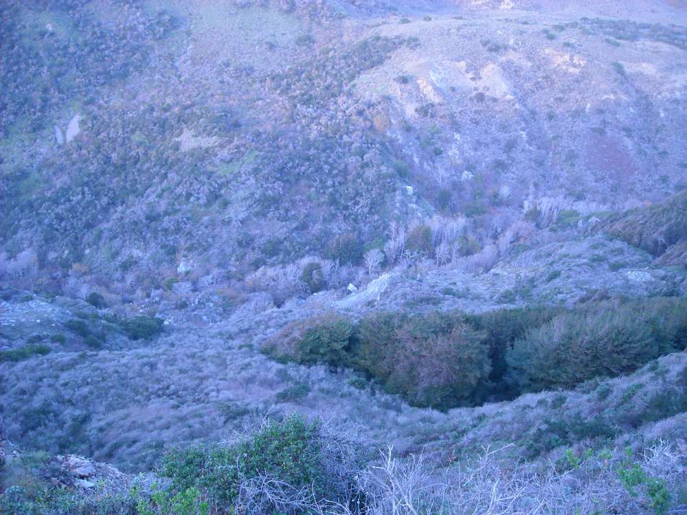
 |
View of the plateau from the south side of Willow Creek. The glider is almost exactly in the center of the frame. Look for a tiny diagonal white line. My hike-out route was up the ridgeline to the left. |
As time ran out, I chose to do a left 270 and land on the plateau. I dropped gently into deep bushes, on a north heading about 1˝ wing spans from the edge of the very steep slope that runs down to the creek. I did not yet realize what a
bad situation I had put myself in. I watched Chris land on the other side not far from a road. He had made a much better choice than I. With his extra altitude he flew out to check the beach landing possibilities. There were none, so he turned left and sped up for a perfect uphill down-wind landing around the 300 foot level above the rocky beach just south of Willow Creek bridge. He was in the bushes, but his retrieval was easy. Mine; however, would prove to be anything but.
I could hear The Big Guy’s voice echo across the canyon as he hollered “PREDATOR”!!! With a little more than two hours of daylight left, I decided to fold the glider, leave it and the harness, and hike out. I just wanted to get out of this remote area and make a plan to recover the glider tomorrow. I did not have enough clothes to stay warm over night, and I had no water or food. From the air I perceived the terrain to be bushy but walkable. I would soon realize that was a radical misperception.
I was able to throw the glider forward a few feet at a time until I reached a partial clearing and folded it to the control bar. Then I headed across the plateau towards higher ground. As I proceeded, the brush got taller and more dense. Mostly, it was well over my head. When I could see ahead, I thought I saw more-walkable areas. I was wrong. I was struggling to move through brush that has not been cleared by fire in maybe 30 to 50 years? The branches were incredibly interwoven. As I tried to lift my feet to step over and through, it almost felt as if there were hands grabbing my legs and around my waist trying to hold me back.
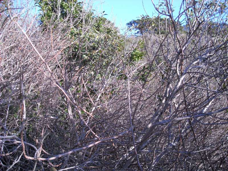 |
The thicket |
Each time I arrived at an area that I had expected to be better, I found it was not. I grew concerned about getting out of the thicket before dark. I felt I must get to the pasture above while I could still see to navigate. I fought my way through brush that would be considered impassable by any rational person. My rest stops consisted of standing still for 10 seconds. The knowledge that there are mountain lions in this forest did not help my optimism, but it did help my motivation. I hurried through the few areas where I could walk above the ground on bigger branches, and struggled through the typical brush that took a minute to go ten feet. I passed through many sections that took five minutes to go ten feet.
After a two hour walk in the woods, I had covered about a quarter mile along the surface and gained about 400 feet in elevation. I broke out into the pasture just as it got dark. I felt much better about things now. I really didn’t know exactly where I was going, but I hoped I would intersect the road up the mountain and get picked up. Turns out I walked almost back to my van on top of the mountain before I ran into the Big Guy and Ken. I just made it to the road as they were driving back down to look for me at the bottom. A bowl of Ken’s veggie stew and a good night’s sleep on top of the mountain were just what the doctor ordered.
I was not very sore in the morning, but I knew I needed some recovery time. We spent most of the next two days in reconnaissance and planning. We didn’t know how, but we knew we had to recover the Big Guy’s glider. We knew it would be crazy to try to carry it through the thicket and up the mountain. We tried to hike up Willow Creek from the beach, but found no real trail. We started exploring the south side of Willow Creek canyon. We could see with binoculars the slope I had landed next to, and it appeared launchable.
Finally, the Big Guy decided that the only way we could retrieve the wing was for me to fly it out. Chris was certainly first with his hand up to fly the glider across the canyon to a retrievable spot. But my harness was already at the glider’s location. It made much more sense for me to do it. Later, I would thank Chris for allowing me the chance to redeem myself. Personally, I needed to be the one to recover the glider from the bad spot I had put it in. The Big Guy knew that before I mentioned it. He’s cool that way.
My first reaction to the Big Guy’s plan (which I kept to myself) was “Fly the glider out!? What, are you crazy?” But it didn’t take long to realize the logic in this idea. The proposed launch slope was not shear, but very steep; obviously an ideal light-wind to no-wind launch. After a short hop across the canyon, the glider would be essentially, back to civilization. It would still take a serious effort to fold and carry the wing out. But it was the difference between do-able and out of the question.
 |
View of the plateau landing site from the south side of Willow Creek. The glider and launch site are in upper right frame. My second landing site is in lower left frame. |
After much searching, we found a trail down towards some possible LZs. All areas within glide of the glider’s location were brush-covered or rock-strewn. We all agreed the brush would be the safest bet. On the second day after my out-landing, I hiked down to examine the possible LZs. There is nothing like checking the LZ, close-up to instill confidence in the flight. I would be looking into the sun just like before, but this time I would have prior knowledge.
The terrain was steep and I would be landing up-hill. Wind direction? Who cares? There is only one way to go in. Wind direction at launch would be another story. The Big Guy and I would start down the mountain in the morning. Ken would be our safety man on the other side with a radio and video camera. We were all up for the adventure. Besides, what could go wrong?
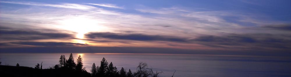
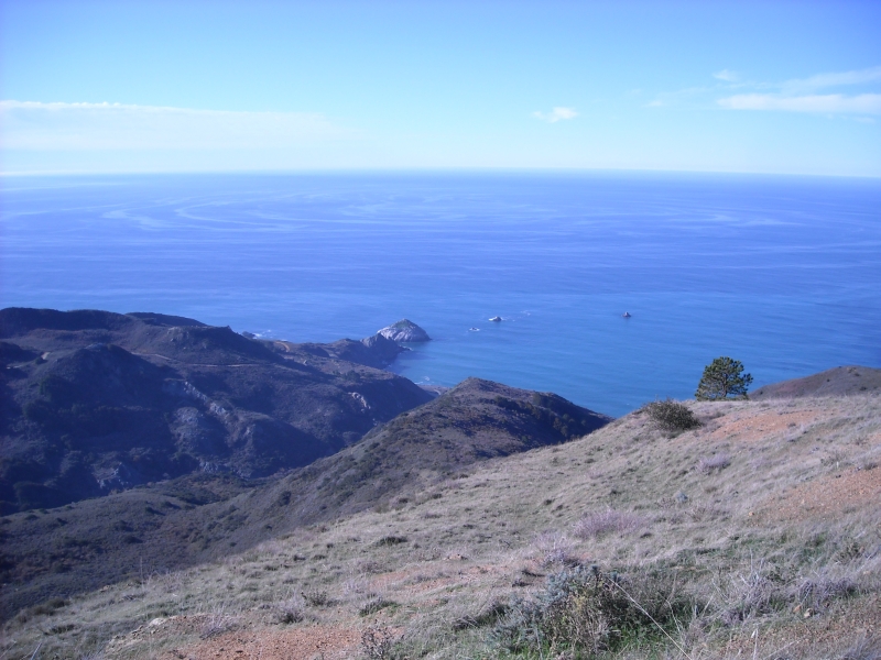 |
There was an odd circular, sort of a bullseye pattern on the ocean just out from the Willow Creek out-flow as we headed down to the glider. |
The walk through the pasture down to the thicket was easy, although our down-hill muscles would ache for days after. From our recon work, we thought we could avoid much of the brush on the way down by traveling along a steep gravel slide area. We did find our way along the edge, but while crossing a small gulley, Chris lost his footing and slid down about twenty feet and stopped at some bushes just before a high drop-off. I went back up and worked my way around the gulley. I happened to be carrying the pack full of gear at the time. I tied a rope to the base of a small bush and threw the other end to Chris. He climbed back up and we continued on.
The route we had chosen by binoculars proved successful. We had made it to a point just above the plateau in good time without much bush-bashing. We disagreed on the best route the rest of the way down to the plateau. Being two strong-headed individuals, we each took our own route. I went left, Chris went right. An hour later as we climbed through the bushes on intersecting courses, we could not see each other until we were about twelve feet apart!
Earlier, when we were still high enough to see the glider, Chris realized we would need a navigation aid once we got into the bush. He suggested we use a peak on the other side of the canyon that was co-linear with our location and the glider. That proved to be extremely helpful as we struggled through the overhead brush, unable to see the glider or much of anything besides brush.
The Big Guy was also concerned about poison oak. I had never had it, so I didn’t know the hazard we were exposing ourselves to. Chris called me when he got home to say that he and KM were seriously contaminated with poison oak. It would be a few more days before my poison oak education would begin. I got a PhD.
Suddenly, I could see what looked like a drop-off. I wondered if it could be the creek canyon where the glider was? In a few more steps we could see it was! We had made it! We stumbled out of the thicket right at the glider thanks to Chris’ nav-aid. The glider was on its side, ostensibly blown over by the wind. It was supported off the ground by the heavy brush, so I decided there could be no airframe damage.
With no time to waste we went right to work checking the proposed launch. It had taken us hours to reach the glider, and we had only a couple hours until sunset. I finished folding the glider to carry it to the launch while Chris stomped down a set-up area. As I set up the glider, Chris cleared sticks from the launch run.
As one might predict, the wind was blowing straight up the Creek canyon from the ocean. It was about 80 degrees cross from the right as I stood at launch. But it was light and the launch run was extremely steep, so it didn’t matter. Chris held a streamer and the digital camera below and to the right. I picked up the glider, forced the basetube through the short brush and stood at the edge. It all felt good so I went, intending to choose one of the three LZs on the fly. With my low wing-loading I was off in about 3 or 4 steps.
I thought about leaving Chris alone in that inhospitable spot with only two hours of daylight to get out. Later he would tell me about his feelings as I flew away. It was an unexpected lonely feeling of being left behind.
But for now, I had to concentrate on getting the bird on a suitable perch. There was some turbulence that tried to turn me away from my goal. I soon realized I would not make the primary LZ. I headed for the secondary and it looked as though I would make it. I sped up for the no-winder and flared full-stretch at the top of the vegetation. I didn’t know how deep it was until I started dropping. I must have fallen ten feet and the basetube was still five feet off the steep slope when I stopped. These were more than bushes. Some of the branches were two inches in diameter.
I stood on branches to un-hook. I struggled for a while with some hamstring cramping from all the exertion. Soon, Ken Muscio was approaching on a trail that he said ended at my landing spot. That was weird. I was thinking we had to move the glider to a better place to fold it, but Ken took over the recovery operation and started de-tangling the branches from the glider. He really made it happen, almost like he had experience. We had the glider folded in short time and began our trip up the long trail out.
The Big Guy made it down to the creek in good time, but there he ran into more, ridiculous jungle. He willed his way through and made it up to our location by sunset. Turns out we should have gone right down to the ocean to get rid of the urushiol oil from the poison oak, ivy or sumac we had contacted. Cold water will wash it off your skin.
In retrospect, I could have landed in the same spot on the first day and avoided the whole ordeal. The Big Guy really made the right decisions in a clutch situation, and pulled off a great landing in the best place. Big Guy and Ken Muscio were great to have on my side for this unwanted project. There were no questions in their minds. They were with me until it was over. I heard that Diev did some hiking up from the bottom to look for me the first night. Thanks Man.
The experience taught us that backside launching is not a guaranty to get out. Ken had postulated the idea that a general north wind was coming up the front at times and up the back at other times. The north caused lee turbulence on the south side of the ridge where it curves west. A south wind would be more likely to make some lift in the same area, which is probably how it was for last year’s backside flights.
It has been a long time since the bush out-landings of my early days. The bushes in Southern California were never like this. More frequent wild-fires I guess. This was a good refresher lesson in emergency decision-making, in making the best of a bad situation and in how great it is to have good buds.
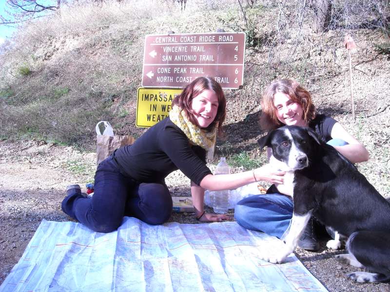 |
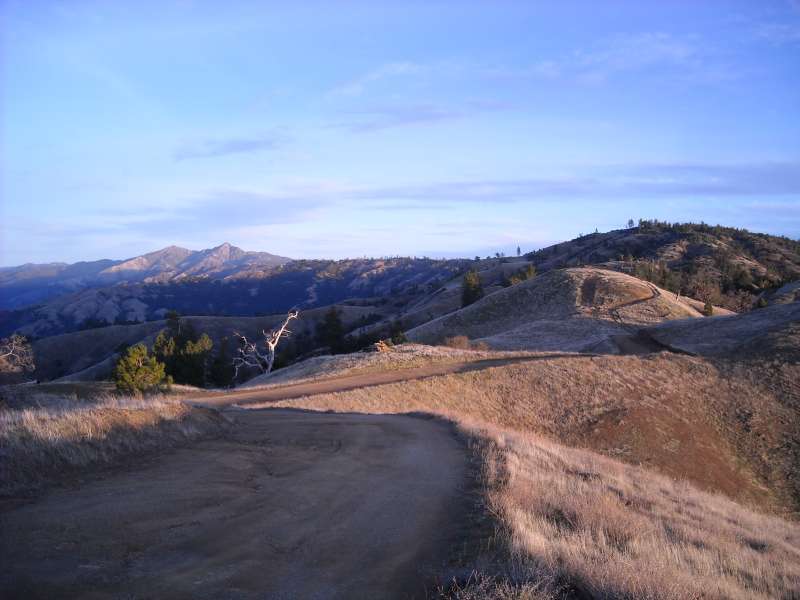
For those of you who left early, too bad. When we drove up Nacimiento Road to check out Cone Peak, we found two friendly Swiss girls exploring the area by car. |
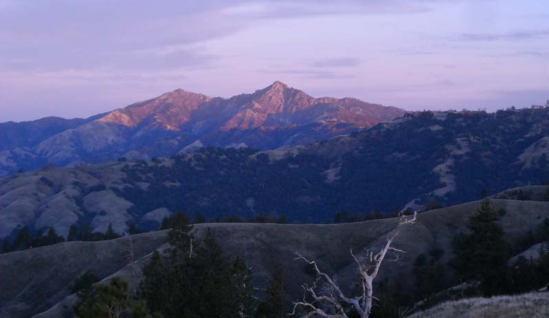 |
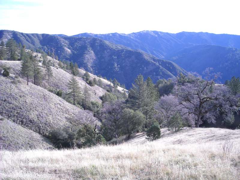
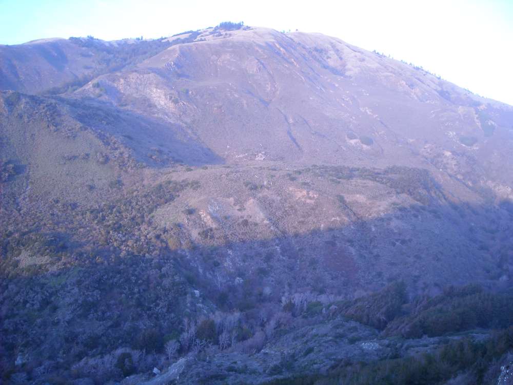
Cone Peak in the early morning as viewed from the Knob Launch area |